Archive for May, 2007

What do you want your mobile phone to do?

Thursday, May 24th, 2007

Daft question, eh?

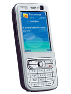
Not really. I have a Nokia N73 and I got it mainly because I needed a new phone (my Treo having been superceded by a Blackberry).

The problem is that as a phone it’s merely ok, which is a pretty damning. My first mobile was an Ericsson GH788 and the comparison is interesting (the photos aren’t to the same scale!).

  Ericsson GH788 Nokia N73
Released 1995 2007
Weight 170g 116g
Dimensions H: 130mm H: 110mm
  W: 49mm W: 49mm
  D: 23 mm D: 19mm
Talktime 2h 6h
Standby 33h 350h
Features Calculator, Calculator, Calendar, Browser, Bluetooth,
  SMS SMS, Camera, Music player, Radio

Ok, so you get a bit more talktime and a bit more standby time nowadays (down to better battery technology), but other than a passable address book (with clunky synchronisation) what’s the difference?

It’s in all that other stuff - a camera (3 megapixels, but the picture gets taken aboput two seconds after you press the shutter), a browser (decent), a calendar (painful), a music player (it’s no iPod) and a radio (good).

On top of that with the Nokia N73 (even with the latest firmware) there are noticeable delays when pressing keys and if you want the keypad to lock automatically you have to use a bit of software written by Petteri Muili (Nokia seemingly believe that you’d prefer to unlock it with a five digit PIN every time).

Now, in my book that’s not a huge amount of progress in 12 years for the mobile phone.

One plausible reason for this lack of progress, is that manufacturers of consumer electronics don’t know what we want and so pack in additional features just to get us to buy new stuff. Mark Hurst of Creative Good writes about this, referring to an article that appeared in the New Yorker this week.

And you know what? That’s why I got the Nokia N73. It wan’t that I needed a camera or a music player or a browser, it was just that I thought they might come in useful (admittedly the browser does). The other stuff, I don’t need. What I would like, though is a phone that works how a phone should - without the horrible lag I get when I want to go from the messaging menu to the calling menu, for example.

The important message here is succinctly put by Mark Hurst so I won’t mess with his words:

A company’s best bet, in the long run, is to deliver what customers really want: and that often isn’t an endless list of features, but a genuine benefit - like productivity - or better communications - or some new skill. Delivering on the long-term value might require more disciplined product development, but it pays out in the end.

As we move forward with Project Red Stripe, we’ll need to keep this top of mind.

Google Maps

Tuesday, May 1st, 2007

I was trying to think of a smart title for this post, but gave up because it doesn’t need one - Google Maps is already smart enough.

Earlier on in our project I asked each of the team to create a map showing where we’d been as a team since the project had started. My aim was to show that there were different ways of describing the same thing and that there wasn’t necessarily a right or wrong way.

The first suprise I got was that half of the team interpreted the exercise as needing to show where we had been geographically and the other half as where we had been mentally as a team. Anyway.

Stew created a map showing the physical places that we had visited using Google Maps. And although Stew is always very enthusiastic about how easy technology is (”It’ll take me a day to do that”), I reckon he took longer to make his map (get an API, create a web page, write some HTML, re-write some HTML, upload the web page etc., etc.) than I did to create this morning. It took me 10 minutes (yes, really) to create four markers with a bit of HTML and to create a line from our offices to the cafe in the nearby park.

This was made possible (not that I haven’t gone through the whole rigmarole of creating one before!) by the release of the functionality on Goole Maps at the beginning of April. Included in My Maps is the ability to add create a KML file from any data that you’ve added using My Maps. What this means is that in one step any map that you create using My Maps is available as an overlay on Google Earth (you just need somewhere to store the KML file so that other people can use it). What Google has done here is, at a stroke, made is so simple to create maps that anyone can do it and so add another raft of customers that they can monetise.

Even before My Maps was released, Google has been slowly adding features to Google Maps. In February, outlines of buildings appeared on maps for some cities in the US and in April these became nearly three dimensional (click on The Economist Group (New York) on the ), as reported by Google Maps Mania. At the same time, some buildings got names and train and subway stops appeared (I have to say that the previous lack of these on UK maps makes Google Maps far inferior to StreetMap as a way of finding your way around and they still don’t show up outside central London).

I guess the question now is, how far will Google go? Will they risk incurring the wrath of other commercial organisations by adding data at a more granular level or leave it to people to do their own thing, like the excellent subway map on onNYTurf (go to the highest zoom level on a station in Manhattan to see what I mean)?

onNYTurf subway map

Way out! I can see the exits (they’re the small red steps)

In the background, meanwhile, some other neat things have started to creep in, such as the undocumented ability to zoom in a bit more when at the highest zoom level when in Satellite View as noted by Google Blogscoped.

I guess that only time will tell whether Google will someday own the Earth (or at least a virtual representation of it)….